Researching the homeland of our ancestors is endlessly fascinating and, sometimes, endlessly frustrating. If your ancestors come from a large, well known metropolis there are scores of books, maps, documentaries, historians, and librarians to feed your hunger for information. On the other hand, if your peasant ancestors hail from an obscure hamlet in the middle of nowhere, you would be lucky to find a mention anywhere that is easily accessible without scouring archives in foreign countries.
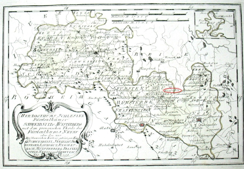
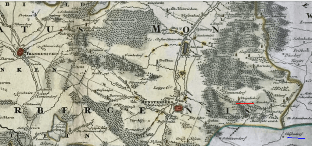
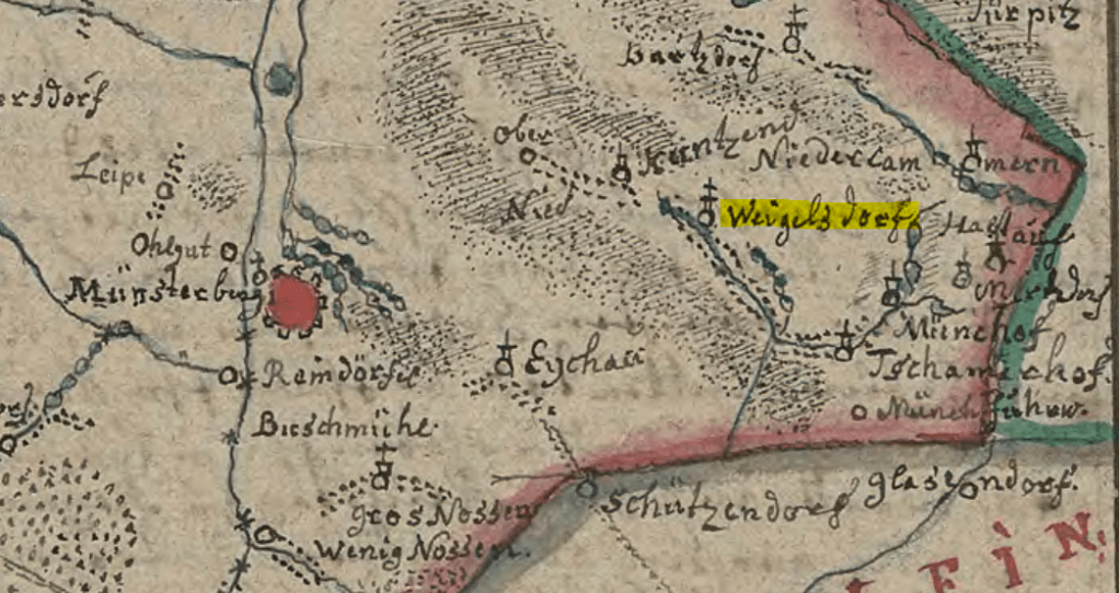
Our Weigel family comes from the village of Weigelsdorf in what was once the Duchy of Münsterberg, Silesia, Germany. After the Second World War, Germany was redefined and Silesia became part of Poland. Weigelsdorf still exists today, but the village is now called Wigancice and is located in the Gmina Ziębice, within Ząbkowice Śląskie County, Lower Silesian Voivodeship, in south west Poland. This tiny village is about 4 miles north east of Ziębice (formerly the town of Münsterberg) and has a population of less than 300. SO – not a large, well known metropolis.
I have been able to dig up a bit of information on the Weigelsdorf village with the help of Maria Prull’s website and a few obscure links on the internet. Although the research doesn’t tell me anything specifically about our ancestors, it does add some color and detail to the picture of their origins in the Old Country and the unnamed generations that came before.
The area that was Weigelsdorf had been fought over for centuries. Various people groups and governments had conquered and been conquered through the ages. By the 13th century, the area was inhabited by Slavic people who were displaced when a Polish Duke opened the area to settlement by Germanic people.
Weigelsdorf has its roots in the legend of Duke Henry I (The Bearded) of Silesia. It seems that Henry was out hunting and somehow fell into a swamp. He struggled but could not seem to get himself out of the muck. Henry was supposed to be very pious and he prayed that if he got out of the swamp alive, he would build an abbey in that very spot. He did, and he did.
The abbey was called Trzebnica Abbey and it was founded in 1202 for the Cistercian Sisters and was the first abbey in what is now Poland. Trzebnica (formerly Trebnitz) is about 12 miles north of Wrocław (formerly Breslau), the capitol city in lower Silesia. Henry I and his wife Hedwig signed the deed of donation on 23 June 1203. Ekbert, Bishop of Bamberg, who was Hedwig’s brother was a witness. German nuns from Bamberg moved into the abbey and in 1218, Gertrude, the daughter of Henry and Hedwig, was made abbess.
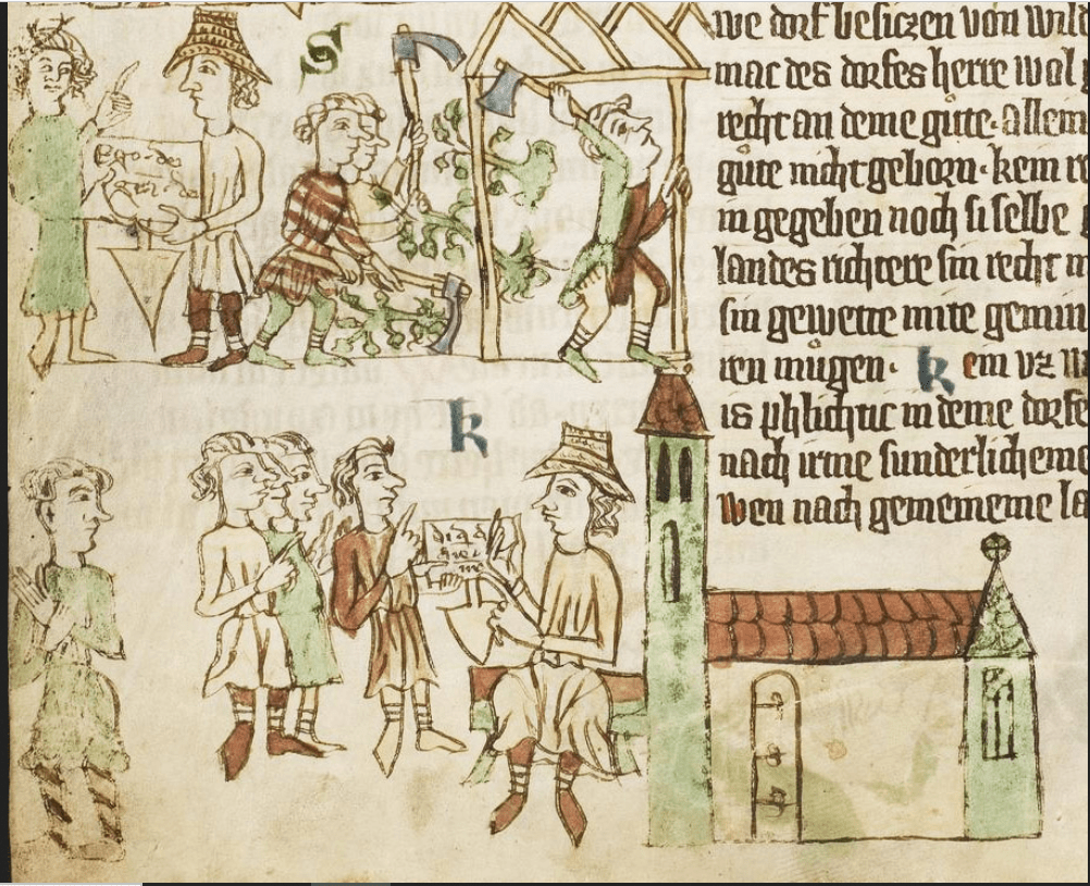
In about 1227, a man named Wygand from Bamberg (a section of Germany then called Franconia) came with his brother Ludwig to help build the abbey at Trzebnica. Then in 1234, Henry and Hedwig donated land around Münsterberg for German settlement and Wygand became the founder (locator) of our little village. Weigelsdorf is mentioned by name in documents as early as 1244. Weigelsdorf is actually noted on several ancient maps and is mentioned in the Heinrichauer Gründungsbuch. The iterations of the village name include vigandi villa, Wygandisdorf, Weigsdorf, Wygancych, Weygamsdorf, Weigelsdorf.
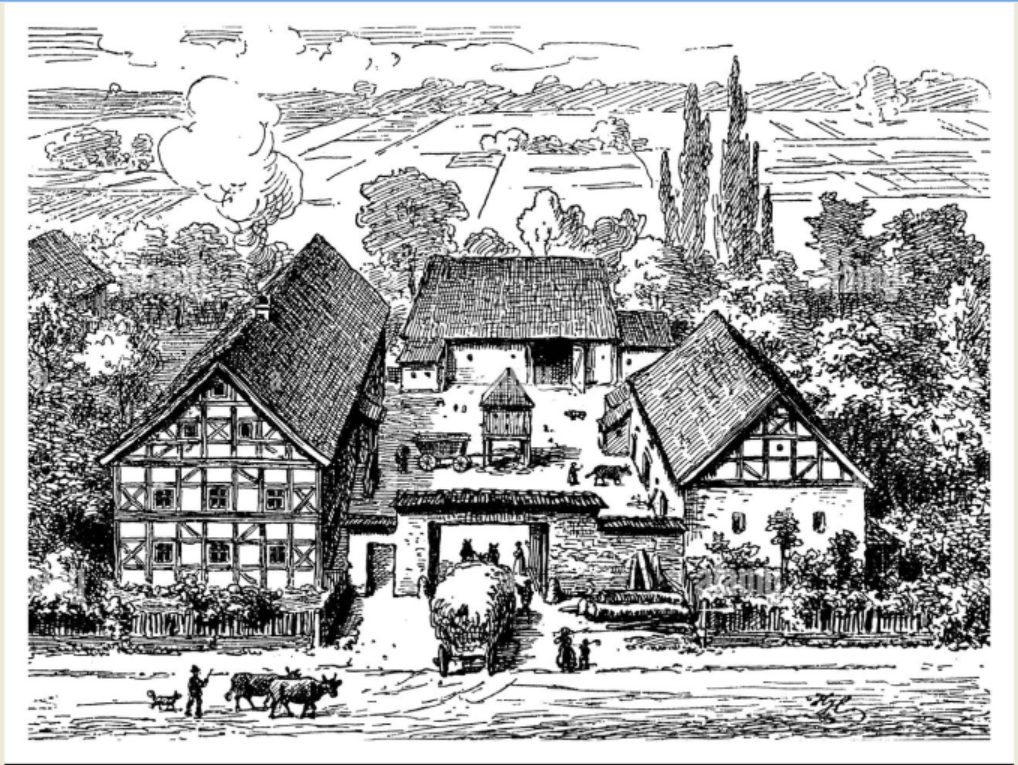
As founder, Wygand was responsible for doling out parcels of land to his fellow Franconian settlers. The village was built along the small creek that runs through the valley. Wooden huts gave way to timber framed homes and barns over the years. Most farms probably started out as byre houses with human occupants on one end of a large building and animal occupants on the other end. Later, many of the farms evolved into the Franconian style which used the house and 2 barns or sheds to enclose a central courtyard. The final wall of the farm had a gate and an arbor along the street. The fields and orchards were behind the barns and a well was located inside the courtyard.
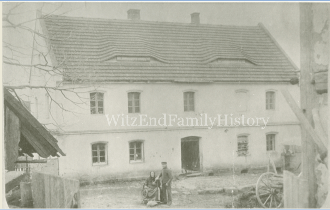
The Weigel homestead seems to have possibly been of this style. The only photo I have of the farm seems to indicate that there are several outbuildings near the house and that the center yard is open. A view from Google Earth of where the farm *should* be, appears as though the 3 large buildings form a U shape. A bird’s eye view of the village indicates several farms laid out in similar style.
I’m endlessly fascinated with ancient things and the idea that part of me comes from this tiny village that was recorded in the 13th century is amazing to me. I wonder if Franz and Amalie knew the origins of the village they lived in. I wonder if they had ancestors who built some of the buildings still standing today. I wonder often if they were born there, if Franz had ancestors who took their name from the village, if we are all named after some guy from Franconia who was a warrior (Wiegand) who settled down by a little creek and built a farm in the 13th century.

Excellent! My father and I visited Wigancice in about 2008, hoping to find tombstones in the church yard or somesuch, but didn’t find anything. Not knowing any Polish, we couldn’t ask anyone anything. Weirdly felt like “home”, though.
Why do you think that Franz & Amelia’s farm was that U-shaped yard, other than that it’s also U-shaped? Do you know about its actual location?
LikeLike
Hi David! I’m not sure if you remember, but we have communicated before, many years ago now.
I think the Weigel farm was U shaped because the founders of the village were from Franconia where that was a common layout for farms. The buildings helped form a fenced area and enclosed the courtyard and well. The farm may have been built by the Weigels or by someone else many years earlier.
They lived at house number 95. The farm is still there as of the latest google maps and I understand it may be used as the parsonage now. It is across the street from St Bartolomaus. I posted a photo of the building in recent years on the faceook page for the blog.
LikeLike
Oh, I do remember writing back and forth onceuponatime, that’s why I knew when I found these pages that they’d be good!
The big thing I didn’t know before was that they lived at house #95. Where did you find that? I wish I knew when Dad and I were there…
LikeLike
It was on the death entry for Franz in the church book. I haveca village map somewhere.
LikeLike
Ah, I see it now. I didn’t realize the significance of the “haus nummer” column.
LikeLike
There is a Facebook page if you are on social media. There is a picture of what I think is their house still standing as of a few years ago
LikeLike